 Back to Search Results
Sold Status
$825,000 Sold Price
Land Type
650 Acres
Sold By
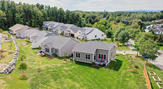
Similar Properties for Sale


Request a Showing or More Info

Call: 802-863-1500
Mortgage Provider


Mortgage Calculator
$
$ Taxes
$ Principal & Interest
$
This calculation is based on a rough estimate. Every person's situation is different. Be sure to consult with a mortgage advisor on your specific needs.
Washington County


One of the largest land offerings in Vermont in the spectacular and sought after Mad River Valley less than 20 minutes from Sugarbush & Mad River Glen, 40 from Stowe. Magnificent canyon rising on both sides with the Baird Brook as it's gateway and the French Brook through its core. Pristine streams, varied geography, knolls, stonescapes and extraordinary view potential across the bowl. State of Vermont Camel's Hump State Park Phen Basin Block to the south, Big Basin Forest to the north. Supremely private and protected with state land to the west & south, VAST trail west of the property. Ash, Maple, Beech, Birch, abundant timber with no recent cutting. Moose, deer, bobcat, coyote, and a public access easement with fantastic hiking trails to ski and snowshoe. Acreage estimated between 575+/- & 650+/ acres. A rare large scale wilderness offering in the cradle of luxury. †
Property Location
Property Details
| Sold Price $825,000 | Sold Date Nov 19th, 2013 |
|---|---|
| MLS# 4255255 | Taxes $10,497 |
| List Price 825,000 | Exposure East, North, South |
| Type Land | Surveyed Yes |
| Zoning RurRes Soil H20 | Road Frontage Ft |
| Lot Size 650.1000 Acres | Water Frontage 7000 |
| Easements | Water Body French & Baird Brook |
| List Date Jul 17th, 2013 |
| MLS# 4255255 | Taxes $10,497 |
|---|---|
| List Price 825,000 | Exposure East, North, South |
| Type Land | Surveyed Yes |
| Zoning RurRes Soil H20 | Road Frontage Ft |
| Lot Size 650.1000 Acres | Water Frontage 7000 |
| Easements | Water Body French & Baird Brook |
| List Date Jul 17th, 2013 |
| Amenities |
|---|
| Topography Adjoins St/Natl Forest, Mountain, Rural Setting, Trail/Near Trail, Wooded, Stream, Walking Trails, Sloping, Secluded, Deed Restricted |
| Location Yes, Rural, Near Skiing, Dead End Street |
| Utilities High Spd Internet-Avail |
| Directions Off Rt 100 take Center Fayston Rd west 4.3 miles. Turn L (south)onto Murphy Rd (becomes Basset Hill Rd) & drive half a mile. ROW is across lawn covered drive just before & below white ranch on a hill on the right. Continue on foot 1/4 mile to other side of bridge where land begins. |
| Current Use Timber | Roads Dead End |
|---|---|
| Sewer None | Roads Dead End |
| Water On Site Well Needed, None | Structure |
| Electric None | Shore Rights |
| Gas None | Restrictions Elevation, Conservation District, Easement/ROW |

† The remarks published on this webpage originate from Listed By Clayton-Paul Cormier Jr of Maple Sweet Real Estate via the NNEREN IDX Program and do not represent the views and opinions of Coldwell Banker Hickok & Boardman. Coldwell Banker Hickok & Boardman Realty cannot be held responsible for possible violations of copyright resulting from the posting of any data from the NNEREN IDX Program.